South Valley Park

Round-Trip Length: 3.69 miles
Trailhead Location: From C-470 and Ken Caryl Avenue take South Valley Road and park in either the north parking lot or continue down to Deer Creek Canyon Road to park in the south lot.

My “go-to” hike this afternoon after doing some yard work at home.  I started from the south parking lot and headed up the Coyote Song Trail.  There were wildflowers out in bloom.

IMG_3337e

IMG_3342 (2)

I decided to take the Lyon’s Back trail up to the top of the ridge (0.02 miles) to catch the views from there.

IMG_3338 (2)

Some of the trees were in bloom and very fragrant.

IMG_3341e (2)

I headed back down to the Coyote Song Trail and continued up to the north entrance of the park.  A sign indicated there was mountain lion activity in the area.

IMG_3343

I always take a slight detour to walk out of the north entrance to see if there are any good reflection shots of the red rocks in Mann Reservoir.  I was in luck today and got some good shots.

IMG_3346e

IMG_3349e

IMG_3347e

After getting my shots, I headed back into the park and headed down the Swallow Trail which eventually hooked back up with the Coyote Song Trail.  This hike is always a great, short hike close to home with great views!

Meyer Ranch

Trail Length: 5 miles round trip
Elevation: 7,890 ft -8,814 ft
Elevation gain: 924 ft.
Difficulty: Easy

Trailhead Location:    Take U.S. Highway 285 south from C-470 towards Aspen Park.  Exit the highway at mile marker 239, turn south onto South Turkey Creek Road to enter Meyer Ranch parking lot.

Last Saturday it was time to decide where to head out for a hike.  The temperature was nice and we decided to stick to a lower elevation and enjoy the warmth.  We hadn’t hiked in Meyer Ranch for a few years, so we decided that would be our destination for the day.

A little history about the park.  Meyer Ranch is part of the Jefferson County Open Space park system and contains 4.3 miles of trails within its 525 acres.  Duncan McIntyre and his family homesteaded the land by 1870.  Louis Ramboz bought the McIntyre property in 1883 and had the present ranch house built in 1889.  He worked the ranch for hay, timber, and cattle until 1912.

Legend has it that in the late 1880s the ranch served as the winter quarters for animals of the P. T. Barnum Circus.  Interestingly, when the most recent private landowner, Norman Meyer, was remodeling the house in 1955, he found a board with the inscription: “Circus Town”.

A portion of what is now Meyer Ranch Park was used in the early 1940s for a ski hill.  Remnants of the ski area are still visible at the upper end of the park, which is now a forested aspen grove.  Norman and Ethel Meyer purchased the ranch in 1950 and used it mainly for grazing and haying.  They continue to reside adjacent to the park.  Jefferson County acquired much of the land in 1986.  The Legault summit was acquired in 2002.

We headed up the Owl’s Perch Trail to the Lodge Pole Loop.

IMG_8654

A short distance up this trail, we turned onto the Sunny Aspen Trail.

IMG_2862

IMG_2863e

IMG_2871e

Most of the trail is in the forest, but as we climbed up higher, we did get a peek of the mountains through the trees.

IMG_2872 (2)

IMG_2874e

We turned onto the Old Ski Run Trail and headed up to the top.

IMG_2866

We climbed up to the highest part of the park and sat on a rock outcropping for a snack and to take in the views.

IMG_2880 (2)

On our way back down we took in the snow-capped mountain views again.

IMG_2881e

IMG_2883e

IMG_2885 (2)

IMG_2886 (2)

IMG_2887e

Back down in the valley looking across at a ranch.

IMG_2890e

We had to capture a selfie of us at the end of the hike!

IMG_3224

Our route:

Meyer Ranch Map

White Ranch Park – Rawhide Loop Trail

Trail Length: 6 mile loop
Trailhead Elevation: 7,478’
Elevation Gain:  707’ net elevation gain
Difficulty: Easy
Trailhead Location:  The Rawhide Loop Trail begins from the West Access Trailhead in White Ranch Park, 9.3 miles from Highway 93 in Golden, Colorado.  Take Colorado Highway 93 north from Golden approximately 1 mile to Golden Gate Canyon Road. Turn west on Golden Gate Canyon Road. Travel west 3.7 miles to Crawford Gulch Road. Bear right onto Crawford Gulch Road and travel 3.9 miles to Belcher Hill Road. Turn right on Belcher Hill Road and travel 1.7 miles to the main West Access Trailhead. If parking is full you may backtrack several hundred yards on Belcher Hill Road to an auxilary parking area on the side of the road.

We hadn’t been out hiking in quite a while as we had been so busy.  Yesterday we finally felt we had the time to get out.  A snowstorm was predicted to blow in today (which it did) so we decided if we wanted to get out, it had to be yesterday.  We headed out to White Ranch Park, a Jefferson County Open Space park.  We hadn’t been here in quite some time.  We decided to hike the Rawhide Loop Trail.  It was only 38 degrees when when we started out but it was sunny.

Our route:

White Ranch Map

White Ranch Park Open Space is dedicated in memory of Paul R White by his wife, Anna Lee White and his family.  The White family homesteaded a portion of this land in the early 1900’s and operated it as a cattle ranch from 1913 to 1969.

Taking in the open views of the meadows as we started down the trail.

IMG_8340 (2)

Looking down on an old barn on the ranch.

IMG_2528 (2)

IMG_2529 (2)

IMG_8397 (2)

We continued on the trail, not really taking that many pictures in the beginning but just enjoying the hike.

IMG_2531 (2)

A view to the east of the plains.

IMG_2530 (2)

We continue up the trail to Princess Anne’s view.

IMG_2532 (2)

IMG_2535 (2)

An interesting tree along the trail.

IMG_8350 (2)

IMG_8351 (2)

At the northern end of the loop we had a nice view of the snow-capped peaks in the distance.

IMG_8356 (2)

We continued on with open meadow views.

IMG_8361 (2)

IMG_8372 (2)

IMG_8376 (2)

A view of North Table Mountain to the east.

IMG_2536 (2)

Heading up the final stretch of the loop.

IMG_3097 (2)

IMG_3096 (2)

IMG_3092

A beautiful panoramic view of the area.

IMG_3099 (2)

Back near the parking lot was a display of several pieces of old farming equipment including a harrow and hake rake.

IMG_8382 (2)

IMG_8389 (2)

It was great to get out after several weeks of not having the time to do so.  Hope we can continue to get out on a regular basis again.

South Valley Park Collection

Round-Trip Length: 2.8miles
Trailhead Location: From C-470 and Ken Caryl Avenue take South Valley Road and park in either the north parking lot or continue down to Deer Creek Canyon Road to park in the south lot.

South Valley Park is another “go-to” hike for something close to home.  It’s a beautiful area with red sandstone rock formations and great reflections in Mann Reservoir.  Below is a collection of photos from different hikes in different seasons we’ve done in South Valley Park.  More detailed blog posting can be found here.

img_8903-2

img_8892-3

img_8905-2

img_6500e1

img_6503ec1

img_6102e1

img_6089e2001

img_37061

img_37081

img_1300e1

img_1508e1

img_1339e1

img_1396e1

img_13111

img_13311

img_13781

img_13861

img_13971

Bergen Peak

Trail Length: 10.3 mile loop
Trailhead Elevation: 7,813’
Elevation Change:  +1,895′ net elevation gain (+2,079′ total roundtrip elevation gain)
Difficulty: Moderate-Strenuous
Trailhead Location:  The trailhead is located 6.7 miles from I-70 in Evergreen, CO. From I-70, take the Evergreen Parkway exit (#252) and continue on Evergreen Parkway (Hwy 74) 5.5 miles to Stagecoach Boulevard. Turn right on Stagecoach and continue 1.2 miles to the trailhead on the right.

Today was predicted to be a fairly nice day (not as much sun as yesterday but still warm with temperatures in the 60’s) and tomorrow was predicted to be a high of only 30 degrees with rain and snow so I knew if I wanted to get a hike in this weekend, it would need to be today (Saturday).  I chose a hike with a little more distance and elevation gain this weekend as I figured it was time to start getting in shape for hikes in the higher elevations this summer!

I headed up to Evergreen and the Elk Meadow Park Open Space.  The parking lot was full when I arrived shortly have 10:00am as I figured it would be since it was Saturday and everyone wanted to get outside before the snow came.  I was fortunate to have a car pull out while I was debating on where I was going to have to go to park so I grabbed it quickly, parked and was ready to hit the trail.

An overview of the route I was about to take:

elk_meadow_map_color

After 0.3 miles hiking down the Meadow Trail, I came to the intersection of the Sleep “S” Trail and the Meadow View Trail.  I took a left on the Meadow View Trail.

IMG_16881

The trails are shared by hikers, mountain bikers, and horseback riders.  A sign alerting mountain bikers to announce themselves to others on the trail.

IMG_16891

After 0.7 miles hiking on the Meadow View Trail, I came to the turn off for the Bergen Peak Trail at 8,022’.

IMG_16901

I started to run into a little more snow on the trail about 35 minutes after turning onto the Bergen Peak Trail.

IMG_16931

Less than 10 minutes later, some good views of the Continental Divide became visible.

IMG_1699e1

At about noon I came to the turn off (9,207’) for the final mile climb up to the summit of Bergen Peak.  This sign warns hikers about horses on the trail.

IMG_1700e1

As I continued to climb in elevation, the snow became deeper along the trail.

IMG_1701e1

A shot from a scenic lookout near the summit.

IMG_1703e1

I arrived on the summit around 12:30pm.  A couple of shots to the west of Mt. Evans (14,265’).

IMG_1704e1

IMG_1718e1

In this close up view of Mt. Evans, if you look closely, you can make out the highway that takes visitors to the top of the summit during the summer.

IMG_1717e1

A shot of me on the official summit of Bergen Peak (9,708’).  I thought the shirt I chose to wear today was appropriate:  “fitness is a journey, enjoy the ride”.

IMG_17291

A view to the south of Pikes Peak (14,114’).

IMG_1707e1

A view looking down on Evergreen Lake.

IMG_1731e1

After spending about 45 minutes on the summit, I headed back down along the snowy trail.

IMG_1734e1

A shot to the southeast as I was heading down.

IMG_1735e1

After hiking back down the Bergen Peak Trail, I took a left onto the Too Long Trail and hiked that for 2.4 miles and then took a right onto the Meadow View Trail to continue my loop.

Another shot looking down on Elk Meadows.

IMG_1736e1

I continued on the Meadow View Trail back to the Meadow Trail and arrived back at the car around 2:45pm.  A great day to get some good mileage and elevation gain in.  Time to head home.

IMG_1737e1

Mt. Falcon Park (Devil’s Elbow Loop)

Trail Length: 3.5 mile loop (Devil’s Elbow)
Trailhead Elevation: 7,760’
Difficulty: Easy
Trailhead Location:  From C-470, exit U.S Highway 285. Drive about 4 miles to Parmalee Gulch Road and turn right. Follow the windy road 2.7 miles to Picutis Road, then follow the signs another 2 miles to the west parking lots.

With temperatures in the mid-60’s last Saturday, we decided to take advantage of the nice weather and get out for a hike.  With the high mountains still full with snow (this has been one of the snowiest seasons in the high country with snowpack totals in some areas nearly double from last year), we needed to pick something at a lower elevation and closer to home.  Jefferson County has many open space options and we decided on Mt. Falcon Park.  There are many trail options here and, even though we have hiked here many times, there was still a section of trail we had never hiked (the Devil’s Elbow loop).

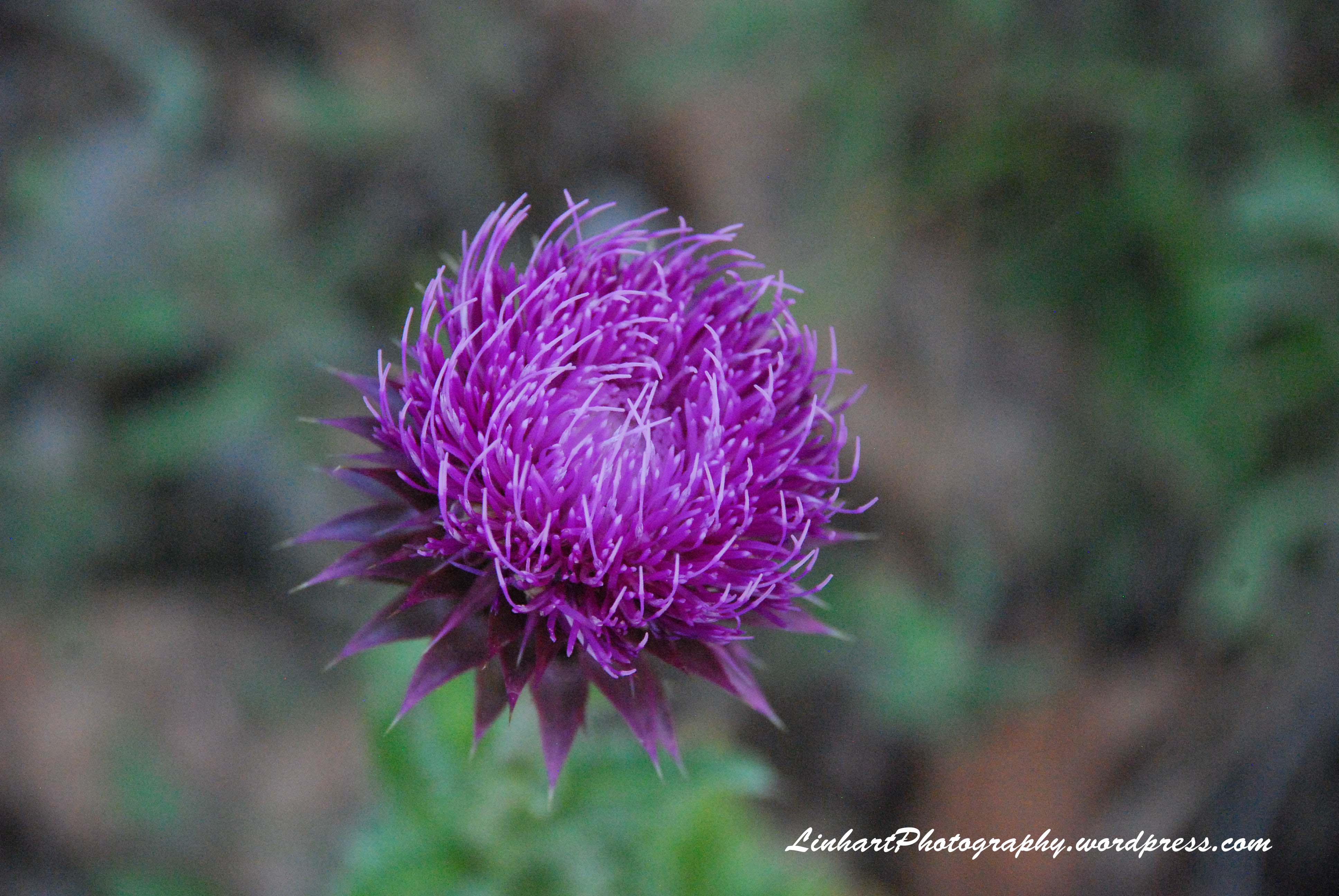
The loop we were about to hike:

mt_falcon_map_color_2011

As we pulled into the parking lot it was probably the most full I had seen it with cars filling both the upper and lower lots and cars parked along the roadside.  I guess everyone had the same idea to get out and enjoy the beautiful weather!  Although there were many cars, when we got out on the trail we really didn’t run into that many people.  It helped that we decided to hike the Devil’s Elbow loop as this trail is not as popular as the Castle Trail.  (click on Castle Trail to see separate trip report from our hike last July on that trail).

We hiked 0.4 miles along the Castle Trail and then took a right and headed down the Meadow Trail for another 0.5 miles until we arrived at the Old Ute Trail.  The Old Ute Trail is a short loop as well so we decided to keep to the right on this trail and return on the other part of the loop on our return trip from Devil’s Elbow.

We continued on the Old Ute Trail for 0.2 miles and came to the Devil’s Elbow lollipop loop.  We continued on.

IMG_15871

Lisa taking in the views to the east and enjoying getting out and getting some fresh air!

IMG_1589e1

A short distance more down the trail we came to the loop portion of the Devil’s Elbow loop.  We headed to the right.

IMG_15911

Some great views of the snow-capped peaks.

IMG_1593e1

More views to the southeast.  A good look at the hogback along the foothills.

IMG_1597e1

Some remains of teeth of wildlife along the trail.  Not sure what animal this is.

IMG_16021

Lisa captured a great starburst looking up at this tree.  I also loved the silhouette of all of the small branches against the blue sky.

IMG_16041

The trail was mostly clear but there was still some snow in areas along the trail.

IMG_1606e1

IMG_1605e1

Another view of the snowcapped peaks off in the distance.

IMG_1607e1

We crossed briefly into the Denver Mountain Parks.  It was a little more forested through this section of the trail.

IMG_1613e1

As we reached the far end of the Devil’s Elbow loop, we had great views to the east of the downtown Denver skyline.

IMG_1615e1

IMG_1616e1

Some more snowy/icy spots along the trail.

IMG_16171

As we continued around the loop, we had more views to the north and west of the snowcapped peaks.

IMG_1619e1

IMG_1620e1

Looking to the north, we could get a glimpse of the castle ruins.  The castle was John Brisben Walker’s home in 1910.  The castle included a library, music room and observation deck.  Here we can just see the top of the chimney.

IMG_1628e1

We continued around the loop, back to the Old Ute loop, and on back to the Meadow Trail with more nice views.

IMG_16251

IMG_1634e1

At the intersection of the Meadow trail and Old Ute trail are a couple of nice benches to stop and take in the beauty of the forest.

IMG_1631e1

IMG_16321

As we continued our hike, we took the Tower trail up 0.6 miles and 250 feet of elevation gain to get to the old fire watch tower. From here you can see Mount Morrison to the north, downtown Denver and the front range to the east and the mountains to the west.

A shot of Lisa enjoying the views from the tower.

IMG_16371

A short distance from the fire watch tower is the Eagle’s Eye Shelter. This was the summer cabin for the Frank Kirchhof family from 1933 to 1972.

IMG_1646e1

IMG_16481

IMG_1651e1

After taking in the views at Eagle’s Eye Shelter, we headed back down the trail and to the parking lot. A great afternoon hike at Mt. Falcon Park.

IMG_16521

As I mentioned, Jefferson County has so many great open space areas to hike in. I love their slogan, “enriching life”. We truly do feel enriched and blessed to live in such a beautiful area when we get out to hike the trails in Jefferson County!

IMG_1647e1


Mt. Falcon Park

Trail Length: 3.6 mile loop
Trailhead Elevation: 7,760’
Elevation Gain:  289’ net elevation gain
Difficulty: Easy

Trailhead Location:  From C-470, exit U.S Highway 285. Drive about 4 miles to Parmalee Gulch Road and turn right. Follow the windy road 2.7 miles to Picutis Road, then follow the signs another 2 miles to the west parking lots.

We wanted to go for a hike last Sunday but the weather didn’t seem to want to cooperate with rain continuing to threaten.  We had about given up but then the clouds appeared to be breaking up.  It was too late in the day to head out too far, but we did decide to head up to Mt. Falcon Park just outside of Morrison Colorado.  It had been over a year since we had hiked here.  We didn’t get to the trailhead parking until around 3:30pm but the afternoon weather turned out to be quite nice.

Arriving at the parking lot.

Mt Falcon Park-Sign

A sign at the beginning of the trail gives the history of John Brisben Walker who once owned over 4,000 acres of land in this area and built a castle for his residence and had plans for building a summer home for the Presidents of the United States here.

Mt Falcon Park-History Sign

As we headed down the Castle Trail, there were many wildflowers along the trail.

Mt Falcon Park-Wildflowers

Mt Falcon Park-Wildflowers

A short distance down the trail, the castle ruins came into view.

Mt Falcon Park-Castle Ruins

Just under a mile, we came to the castle ruins.  The castle was John Brisben Walker’s home in 1910.  The castle included a library, music room and observation deck.  In 1918, Walker’s mansion was hit by lighting and burned.  Pictures of the remaining stone walls of the castle.

Mt Falcon Park-Castle Ruins

Mt Falcon Park-Castle Ruins

Mt Falcon Park-Castle Ruins

Mt Falcon Park-Castle Ruins

Mt Falcon Park-Castle Ruins

We continued on down the Castle Trail to the site of the proposed Summer White House.  Along the way we had great views out towards Red Rocks Amphitheater.

Mt Falcon Park-Redrocks

Mt Falcon Park-Redrocks

More wildflowers along the trail.

Mt Falcon Park-Wildflowers

After about 1.6 miles, we came to the turnoff for the proposed Summer White House.

Mt Falcon Park-Trail Sign

Another 0.3 miles up this trail and we arrived at the site.  Walker had a big dream of building a summer home for the Presidents of the United States on a hill about a mile away from his castle. A foundation was laid, then a marble cornerstone. With America joining World War I, Walker’s dream ended and the Summer White House was never built.

A sign depicting Walker’s plans for the Summer White House.

Mt Falcon Park-Summer White House Sign

The marble cornerstone that was laid.

Mt Falcon Park-White House Cornerstone

A view from the planned site of the Presidents summer home.

Mt Falcon Park-

A view to the southeast looking down along the hogback.

Mt Falcon Park-Hogback

A view to the east of downtown Denver.

Mt Falcon Park-Downtown Denver

We headed back down to the Castle Trail.  More wildflowers along the trail.

Mt Falcon Park-Wildflowers

Mt Falcon Park-Wildflowers

Mt Falcon Park-Wildflowers

A view to the west as we continued back along the Castle Trail.

Mt Falcon Park

Near the castle ruins, we came to the junction with the Meadow Trail and decided to take this trail back to the parking lot.

Mt Falcon Park-Trail Sign

More wildflowers along the trail.

Mt Falcon Park-Wildflowers

We encountered some deer as we were heading back.

Mt Falcon Park-Deer

Mt Falcon Park-Deer

Mt Falcon Park-Deer

The early evening sun and clouds provided for some great views.

Mt Falcon Park

A few puddles along the trail from earlier rains provided for some nice reflection pictures.

Mt Falcon Park-Reflection

Mt Falcon Park-Reflection

Some more shots as we headed back.

Mt Falcon Park-Clouds

Mt Falcon Park-Dead Tree

Lisa heading down the trail.

Mt Falcon Park-Lisa Hiking

We arrived back at the car around 6:30pm just as a few drops of rain started to fall.  As we headed back down the road for home, we were treated to a beautiful rainbow – a great way to end the day.

Mt Falcon Park-Rainbow